
Table of Contents
- Exploring Troodos Waterfalls: Caledonia and Millomeris Trails Overview
- Caledonia Trail: A Journey Through the Kryos Potamos Valley
- Millomeris Waterfall: The Tallest Cascade in Cyprus
- Getting There by Car: Driving Directions and Parking
- Comparison Guide: Caledonia vs Millomeris
- Essential Gear and Best Times for Troodos Hiking
- Exploring Pano Platres and Surrounding Village Life
- Sustainability and Nature Conservation in the Troodos Range
- Frequently Asked Questions About Cyprus Waterfalls
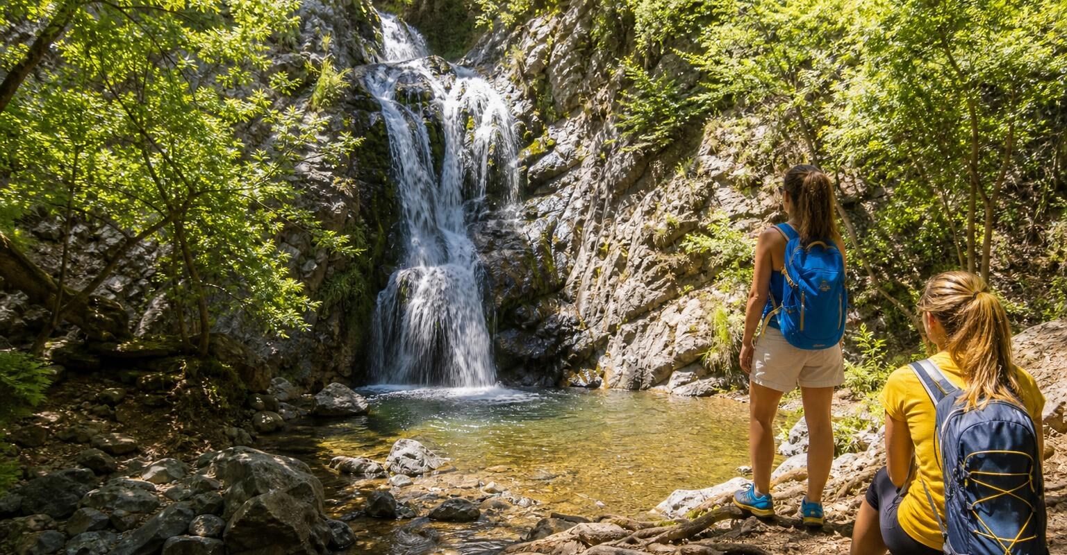
The Troodos Mountains hold two of Cyprus’s most rewarding waterfall walks, both accessible from the village of Pano Platres at roughly 1,100 metres elevation. Caledonia waterfall, fed by the cold Kryos Potamos river, drops around 12 metres through a forested ravine, while Millomeris plunges some 15 metres down a sheer rock face just a short drive away. If you’re renting a car and spending a day in the mountains, you can comfortably visit both in a single outing.
These trails reopened in spring 2026 after a period of closures, and the surrounding forests show visible signs of recent environmental stress. That context matters: the Troodos you’ll walk through this year looks different from the one in older guidebooks. This guide covers everything you need to plan both hikes, from trailhead logistics and gear to seasonal timing and the villages worth stopping in along the way.
Exploring Troodos Waterfalls: Caledonia and Millomeris Trails Overview
The Troodos range sits at the heart of Cyprus, with Mount Olympus reaching 1,952 metres at its peak. Rain and snowmelt feed a network of streams that cut through valleys dense with black pine and golden oak. Two waterfalls near Platres have long drawn hikers: the Caledonia falls on the Kryos Potamos river, and the Millomeris falls on a tributary closer to the village.
Both trails were among 15 nature trails officially reopened on 25 April 2026 by the Cyprus Department of Forests, following closures for weather-related damage and safety maintenance. Trail surfaces, handrails, and signage received upgrades during the closure period. Conditions are now good, though certain sections still demand careful footing.
What makes these two walks worth combining is their contrast. The Caledonia trail is a longer forest walk with multiple river crossings, while Millomeris is a short, steep descent to a single dramatic cascade. Together, they offer a full morning or afternoon in the mountains without requiring advanced fitness.
Tip: Check trail status with the local forestry station before setting out, especially after heavy rain. Conditions can change quickly in the Troodos, and temporary closures do happen.
Caledonia Trail: A Journey Through the Kryos Potamos Valley
The Caledonia trail is a linear path measuring approximately 3.5 km (2.2 miles) one way, following the Kryos Potamos river downstream through a shaded valley. The walk takes most people between 60 and 90 minutes in one direction, depending on pace and how often you stop for photos. Elevation change is moderate: you’ll descend roughly 200 metres if starting from the upper (north) trailhead.
The path passes through stands of Calabrian pine, plane trees, and wild strawberry bushes. The river is audible for most of the route, and you’ll cross it several times on stepping stones and small wooden bridges. The waterfall itself sits at the southern end of the trail, where the river drops over a mossy rock ledge into a shallow pool.
This isn’t a strenuous hike by mountain standards, but the uneven terrain and wet crossings mean it’s not a casual stroll either. Families with children regularly complete it, though younger kids will need a hand at the river crossings.
Navigating the North and South Trailheads
The trail has two entry points. The northern trailhead sits beside the Troodos-Platres road (B8), roughly 3 km above Pano Platres at an elevation of about 1,300 metres. A small car park here accommodates perhaps 15 to 20 vehicles. This is the more popular starting point because the walk is mostly downhill to the falls.
The southern trailhead begins near the Psilo Dendro trout farm, at the edge of Pano Platres. Starting here means you’ll climb uphill to the waterfall, which is more demanding but has the advantage of ending your walk back in the village, close to cafés and restaurants.
If you’re hiking with a group and have two cars, you can leave one at each end and walk the trail one way. Solo visitors or couples usually start at the top, walk down to the falls, and then either retrace their steps or arrange a taxi back from Platres.
Managing Slippery River Crossings and Terrain
The river crossings are the main challenge on this trail. Stepping stones and wooden planks span the water at several points, and they’re often wet and slippery, particularly in spring when snowmelt keeps the river high. Trekking poles help enormously here.
The path itself alternates between packed earth, exposed tree roots, and rocky stretches. After rain, mud can make sections tricky. The 2026 trail upgrades improved some of the worst spots, but this remains a natural forest path rather than a manicured boardwalk.
Warning: Avoid crossing the river at unmarked points. The rocks are deceptively slippery, and a twisted ankle deep in the valley means a difficult evacuation. Stick to the designated crossings, even if they add a few extra minutes.
Millomeris Waterfall: The Tallest Cascade in Cyprus
Millomeris is often cited as the tallest waterfall in Cyprus, with water dropping roughly 15 metres down a vertical limestone cliff face. The falls sit in a narrow gorge about 1.5 km from Pano Platres, and reaching them requires a short but steep descent on a maintained path with steps and metal handrails.
The walk from the car park to the base of the falls takes around 15 to 20 minutes. It’s far less demanding than the Caledonia trail, making it a good option for visitors with limited mobility or those short on time. The gorge is shaded and cool even in summer, and the spray from the falls creates a noticeable temperature drop.
Water flow at Millomeris varies dramatically with the season. In late winter and spring (January through April), the cascade is at its most impressive. By August and September, it can slow to a trickle or stop entirely during drought years. The consecutive dry spells between 2022 and 2025, which caused significant Brutia pine die-offs from bark beetle infestations across the Troodos, also reduced stream flow in many of these smaller watersheds.
Getting There by Car: Driving Directions and Parking
Both waterfalls are most easily reached by car from Limassol, which sits about 40 km to the south.
- From Limassol: Take the A1 motorway west, then exit onto the B8 road signposted for Platres and Troodos. The drive to Pano Platres takes approximately 45 minutes. The road is fully paved and well-maintained, climbing steadily through vineyards and pine forest.
- From Paphos: Head east on the A6, then turn north towards Mandria and follow mountain roads through Phini. Allow about 75 minutes. Some stretches are narrow with sharp bends.
- From Nicosia: Take the A1 south, then the B8 north from Limassol junction. Total drive time is roughly 90 minutes.
For the Caledonia trail’s upper trailhead, continue past Pano Platres on the B8 towards Troodos square. The car park is on your left after about 3 km. For Millomeris, follow signs from Pano Platres village centre: the car park is a short drive or 15-minute walk from the main square.
Parking at both sites is free but limited. On weekends between May and October, spaces fill quickly by mid-morning. Arriving before 09:00 is sensible during peak season.
Important: Most car rental agreements in Cyprus exclude driving on unpaved roads. Both waterfall car parks are reached via paved roads, so you won’t have issues. Stick to marked routes and avoid any dirt tracks you might spot leading into the forest. Rental insurance from the Republic of Cyprus also does not cover the north of the island.
Comparison Guide: Caledonia vs Millomeris
| Feature | Caledonia Falls | Millomeris Falls |
|---|---|---|
| Height | ~12 metres | ~15 metres |
| Trail length | 3.5 km one way | ~1.5 km return |
| Walking time | 60-90 min one way | 15-20 min one way |
| Difficulty | Moderate (river crossings, roots) | Easy (steps, handrails) |
| Best water flow | February – May | January – April |
| Parking | Small lot on B8 road | Small lot near Platres |
| Suitable for children | Yes, with supervision at crossings | Yes |
| Wheelchair accessible | No | No (steep steps) |
Caledonia is the better choice if you want a proper forest walk with varied scenery. Millomeris suits visitors who want a quick, impressive payoff without a long hike. Doing both in a single day is straightforward: start with the Caledonia trail in the morning, have lunch in Platres, then visit Millomeris in the early afternoon.
Essential Gear and Best Times for Troodos Hiking
Seasonal Water Flow and Weather Considerations
The Troodos mountains receive most of their precipitation between November and March, with snow common above 1,400 metres from December through February. Spring (March to May) offers the best combination of strong water flow and comfortable hiking temperatures, typically between 10°C and 20°C at trail elevation.
Summer brings warm, dry conditions. Daytime temperatures around Platres hover between 25°C and 30°C from June through August, which is pleasant for walking but means reduced water at both falls. Autumn is dry and mild, with the forest taking on golden tones but the waterfalls often at their weakest.
Winter hiking is possible but comes with caveats. Snow and ice can make the Caledonia trail’s river crossings hazardous, and the road to the upper trailhead may require snow chains. Check road conditions with the police or forestry department before heading up between December and February.
Recommended Footwear and Safety Equipment
Proper footwear makes the biggest difference on these trails. Sturdy hiking shoes or boots with good ankle support and grippy soles are essential for the Caledonia trail. Trainers or sandals are genuinely dangerous on the wet river crossings. For Millomeris, any closed-toe shoe with reasonable grip will do.
Beyond shoes, consider packing:
- Trekking poles (especially useful for Caledonia’s crossings)
- At least 1 litre of water per person
- Sun protection: hat, sunscreen, sunglasses
- A light waterproof layer, even in summer: mountain weather shifts fast
- A basic first aid kit with blister plasters and antiseptic wipes
- A fully charged phone: mobile signal is patchy in the valley
Exploring Pano Platres and Surrounding Village Life
Pano Platres sits at roughly 1,100 metres and has served as a hill station retreat since the British colonial era. The village has a handful of tavernas, a couple of small hotels, and a pleasant central square shaded by plane trees. It’s a good base for a day of waterfall walks, and the food is honest mountain fare: grilled halloumi, kleftiko, local trout from the nearby farms.
The village comes alive on weekends when Cypriots from Limassol drive up to escape the coastal heat. Weekday visits are quieter and parking is easier. A few shops sell local honey, preserves, and handmade sweets.
Nearby, the village of Phini is known for its traditional pottery workshops, and Omodos (about 20 minutes’ drive south) has a well-preserved village square and the Timios Stavros monastery. If you’ve got a rental car, stringing together a waterfall morning with an afternoon village tour makes for a full and satisfying day in the mountains.
Pro Tip: The trout farms near Psilo Dendro, at the southern end of the Caledonia trail, serve freshly caught trout cooked simply with lemon and olive oil. It’s one of the better meals you’ll find in the Troodos, and it’s right at the trailhead.
Sustainability and Nature Conservation in the Troodos Range
The Troodos forests are under real pressure. Consecutive drought years between 2022 and 2025 weakened Calabrian pine stands across the range, leaving them vulnerable to bark beetle outbreaks that killed significant numbers of trees. You’ll notice patches of brown and dead pines along the trails, a visible reminder that these ecosystems are not static.
A €1 million Integrated Regeneration Programme launched in June 2026 aims to support the long-term recovery of Troodos communities and watersheds following 2025 wildfires. The programme covers reforestation, watershed management, and support for affected villages.
Conservation work also extends to the waterways. The Kryos Potamos and its tributaries are habitat for endemic freshwater species, and habitat restoration for the critically endangered fish Pseudophoxinus cyprius is an active priority for conservationists. Hikers can help by staying on marked trails, not disturbing riverbed habitats, and carrying all rubbish out.
The Cyprus Organisation for Standardisation published national standards for hiking trail design and difficulty marking in late 2025, part of a broader push to develop mountain and rural tourism sustainably. These standards should gradually improve trail quality and consistency across the island.
Frequently Asked Questions About Cyprus Waterfalls
How long does it take to walk the Caledonia trail?
The 3.5 km trail takes most hikers between 60 and 90 minutes one way. If you start from the upper trailhead and walk to the falls and back, budget around two to three hours total, including time to rest at the waterfall.
Can I visit both Caledonia and Millomeris waterfalls in one day?
Absolutely. The two sites are only a few kilometres apart by road. A typical itinerary would be the Caledonia trail in the morning, lunch in Pano Platres, and the Millomeris walk in the early afternoon. You’ll still have time to explore nearby villages before heading back to the coast.
Is the Millomeris waterfall worth visiting in summer?
It depends on the year’s rainfall. In dry summers, the flow can be very thin or stop altogether. Spring visitors (February through April) see the strongest cascades. If you’re visiting in July or August, check with locals in Platres about current conditions before making the walk.
Do I need a 4×4 to reach the trailheads?
No. Both car parks are accessible via paved roads suitable for any standard rental car. The B8 road from Limassol to Troodos is well-maintained year-round, though snow chains may be required in winter months above 1,400 metres.
Are the trails suitable for children?
The Millomeris trail is manageable for most children, though the steps are steep. The Caledonia trail works for older children (roughly age 7 and up) who are comfortable on uneven ground, but younger kids will need help at the river crossings. Neither trail has pushchair access.
The Troodos waterfalls reward visitors who come prepared and time their visit well. Spring remains the ideal window: the rivers run strong, the forest is green, and the trails are in good condition after the 2026 reopening. Whether you choose the longer forest walk to Caledonia or the quick descent to Millomeris, a day in these mountains is time well spent. Pack proper shoes, bring water, and give yourself enough time to enjoy the villages along the way. If you’re exploring Cyprus by car, the Platres area is one of the most accessible mountain destinations on the island, and one of the most rewarding.